
About
An independent drone survey business
Thermal and visual data from the air for property professionals, farms and estates across London and the South.
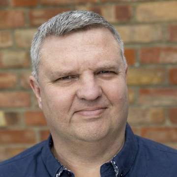
Chris Walker
Founder and pilot
Hello, I’m Chris
I set up ThermaDrones to give surveyors, property managers and landowners a clearer view of their buildings and land, without scaffolding, ladders or guesswork.
Before drones, I spent more than 20 years in software sales, helping organisations get the right information to the right people. That shapes how I work: every job ends with data that drops straight into your own reports and systems, not a folder of pictures to sort through.
I’m also a keen photographer and a member of my local camera club, so a clean, well-composed image matters to me. For thermal and close-up work I fly a DJI Matrice 4T, a compact Mini 5 Pro gets into tight spots, and where no drone can go I photograph from the ground.
What you can expect
- Straight answers. If a drone isn’t the right tool, I’ll say so before you spend anything.
- Your format. Registers and images set up around your reports and systems.
- Like-for-like repeats. The same flights each year, so you can compare change over time.
- Properly set up. CAA A2 qualified, £5m public liability cover, and PCN Level 1 thermography training in December 2026.
Working with surveyors
I’m not a surveyor and don’t try to be one. I capture and organise the evidence, and the diagnosis stays with the professionals who sign off the work. If you’re a surveyor, architect or facilities team wanting aerial thermal data in your own services, let’s talk.
Tell me what you need
Send the address, a photo or two and what you need to find out.

